Routes are organized by the counties of their start location. Consult the map and the table below for help looking for a route in a particular area or municipality. The map and table represent the Greater St. Louis metropolitan area.
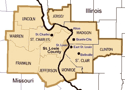
Click on the County name in the tables below to browse for routes
| Missouri Counties | |||||
|---|---|---|---|---|---|
| St Charles | St Louis City | St Louis | Jefferson | Franklin | |
|
|
|
|
|
|
| Illinois Counties | |||
|---|---|---|---|
| Madison | Monroe | St Clair | Jersey |
|
|
|
|
Want to add a route to the library? Click the button below